

Top Features of DJI Modify
Here are the top features of DJI Enterprise's new 3D model editing software
For over ten years, DJI has been synonymous with cutting-edge drone technology, particularly in the commercial drone sector through DJI Enterprise. In recent times, DJI Enterprise has further enhanced its software offerings, introducing the cloud-based fleet and mission management platform, Flighthub 2, and continuously upgrading its UAV 3D modeling software, DJI Terra.
Now, DJI unveils another milestone in its commitment to providing comprehensive solutions for professional survey users. Introducing DJI Modify, the latest innovation poised to revolutionize 3D model editing and reshape the industry landscape.
Introducing DJI Modify, DJI's groundbreaking entry into the realm of intelligent editing software. With its user-friendly interface, DJI Modify streamlines the digital model editing process, making it more accessible than ever before. When paired with a DJI Enterprise drone and DJI Terra, it forms a seamless integration, providing a comprehensive solution that encompasses aerial surveying, modeling, and model editing.
This all-in-one platform is designed to meet the diverse operational needs of various industries, including surveying and mapping, urban planning, firefighting, and emergency response. It facilitates efficient sharing of models, catering to the demands of a dynamic landscape.
Here's everything you need to know about DJI Modify:
Seamless Workflow with DJI Terra
DJI Modify seamlessly combines with DJI Terra, creating a complete solution for aerial surveying, modeling, and effective model editing. The process is streamlined, guaranteeing a smooth transition from modeling to model editing, effectively fulfilling the operational requirements of professionals in diverse industries.
Launching DJI Modify within a DJI Terra 3D modeling project is a simple one-click procedure. This integration simplifies the model editing process, offering efficiency and a comprehensive solution. DJI Modify's integration with DJI Terra automatically generates files for model editing, encompassing pre-identified objects and model pre-processing.
Work Efficiency & Smooth Operations
The streamlined interface of DJI Modify encourages intuitive interaction, enabling users to quickly start working without extensive training.
The software efficiently executes model file operations and editing tasks, including automatic texture repair and batch flattening of vehicles, thereby reducing the workload associated with model editing.
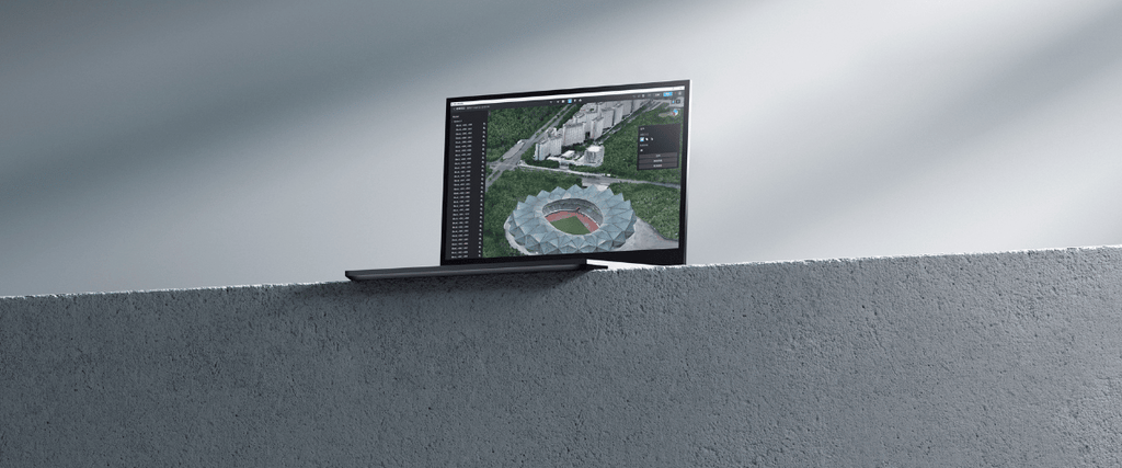
Utilizing advanced model display technology, DJI Modify enables users to view and edit both high and low-quality models within a single interface, offering flexibility for different scenarios.
Efficient 3D Model Retouching
DJI Modify demonstrates exceptional proficiency in repairing 3D models captured by drones, effectively resolving concerns such as floating parts, anomalies on water surfaces, mesh irregularities, and texture issues. Below are examples showcasing how DJI Modify efficiently performs typical modeling repairs:
Floating Parts Removal: This feature enables effortless removal of floating parts through various selection methods, simplifying the cleaning process.
Flattening: Users can flatten selected areas, ideal for scenarios like removing vehicles from a parking lot or smoothing out specific areas of the map.
Texture Repair: The Texture Repair function enables precise erasing, cloning, and repairing of textures, ensuring a seamless and aesthetically pleasing result.
Fill Holes: The Fill Holes tool utilizes machine learning to generate new mesh and fill in gaps in thin structures or areas with insufficient overlap.
Water Surface Repair: DJI Modify smartly repairs water surfaces, allowing users to adjust the range, height, shape, and position for optimal results..
These repairs will enhance the final model deliverables, allowing architects, engineers, surveying professionals, urban planners, or other professionals, to have a smoother digital model to work on and make accurate decisions.
Cloud Sharing, Quick Delivery
Effective collaboration between teams is pivotal in large-scale projects, particularly in fields like infrastructure and urban planning. However, sharing aerial survey data and 3D model files can be cumbersome due to their dependence on specialized software like DJI Terra.
To address these obstacles, DJI Modify offers a solution by streamlining the rendering and exporting process of models into multiple formats compatible with DJI Terra and other third-party software. This enables swift sharing of processed models via cloud platforms, allowing stakeholders to access and view them online using a web browser on their mobile devices or computers, without the need for additional software installations.