

LiDAR vs Photogrammetry for Aerial Surveying
A comparative guide to help you select your surveying sensors
LiDAR and Photogrammetry have long been essential tools for professionals in surveying and mapping. However, recent advancements in drone technology have revolutionized the way data is gathered, yielding significant benefits.
In contrast to the conventional approach of using manned aircraft for aerial surveying, drones provide a safer, more precise, and cost-effective alternative. This transformation has democratized surveying solutions, extending their utility to diverse sectors such as agriculture, construction, conservation, mining, crash scene reconstruction, and more. These sectors can now access detailed point clouds, accurate maps, and 3D models to enhance their projects.
Whether you're an experienced surveyor or a newcomer, the choice between LiDAR and Photogrammetry is likely a familiar consideration. This article aims to guide you through the advantages and disadvantages of both techniques. It's important to note that there isn't a definitive superior method; the optimal choice depends on the specific task, the operator's skill set, and, of course, the available budget.
What is LiDAR?
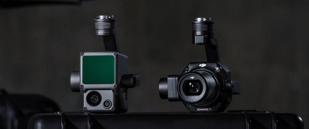
LiDAR stands for 'light detection and ranging.' Operating through the emission of light pulses, LiDAR sensors gauge the duration taken for these pulses to bounce off the ground and measure their corresponding intensity.
Despite its existence for many years, only recently has LiDAR technology advanced to a point where it can be condensed and fitted onto a drone for aerial deployment.
The LiDAR sensor constitutes just a single component within a intricate process. In order to amass the requisite data for generating a precise point cloud depicting the landscape and its contours, LiDAR integrates additional systems of exceptional accuracy: satellite positioning (GNSS data) and an inertial measurement unit (IMU).
Through the application of software wizardry, the data captured from LiDAR flights can be harnessed to construct 3D point clouds and intensity maps. Although deciphering these outputs demands a certain level of expertise, they yield invaluable information for endeavors encompassing mining, forestry, agriculture, and construction.
The Pros of LiDAR
The most frequently cited advantage of employing LiDAR for mapping is its exceptional accuracy. However, when presented as a standalone statement, this description lacks detailed insight.
Primarily, it's essential to contemplate the interpretation of accuracy within the context of your project. Are you emphasizing relative accuracy or absolute accuracy? In simpler terms, are you focused on ensuring that your final output accurately represents the relationships between its features, or are you concerned with accurately situating those features within the real world?
For achieving absolute accuracy, LiDAR stands out as the optimal choice, particularly when striving for a lifelike representation of the bare earth. This preference arises from its capacity to comprehensively account for elevation variations, vegetation cover, and prevailing conditions.
LiDAR's integration with GNSS data and its intrinsic nature as a direct measuring technique—emanating numerous laser pulses from an aerial perspective—guarantee an extremely precise vertical dimension within your ultimate digital terrain map.
Topographic complexities extend beyond mere variations in terrain elevation. The presence of vegetation can obstruct the efficacy of surveying methods reliant on imagery, impeding the acquisition of detailed ground-level data.
LiDAR's emitted light pulses possess the capability to navigate through foliage, effectively traversing gaps between leaves and branches to reach the underlying ground surface. This characteristic significantly enhances measurement precision.
LiDAR also holds an advantage in scenarios where lighting conditions at the survey site are inconsistent. Whether conducting surveys during nighttime or in conditions of limited visibility, LiDAR can perform admirably without dependence on external light sources.
Furthermore, LiDAR excels at capturing minute details. For instance, consider the case of slender objects like power cables. By virtue of its high-density point sampling and direct measurement methodology, LiDAR proves adept at accurately mapping the trajectory of cable sag.
The Cons of LiDAR
The foremost challenge associated with utilizing LiDAR revolves around its cost implications. Due to its heightened operational intricacies, necessitating advanced components and sensors, the investment required for a comprehensive survey solution can easily escalate into the hundreds of thousands of dollars.
This complexity simultaneously introduces a broader margin for potential errors and intensifies the reliance on seasoned professionals. Given the involvement of multiple sensors and data that demands substantial processing, extracting the requisite information isn't a straightforward endeavor.
It's essential to acknowledge that historically, LiDAR sensors have been larger in size compared to simple cameras. As drones gain popularity as tools for aerial surveying, accommodating a weightier payload might mandate a larger drone, thereby augmenting an already considerable expenditure.
Paradoxically, LiDAR's most formidable strength could be perceived as a drawback. Its specialty lies in specific scenarios where it excels uniquely. However, this singularity of function also means that for many applications, conventional photogrammetry suffices. This trend is gaining momentum, driven by advancements in image processing software.
What is Photogrammetry?
In simple terms, photogrammetry entails the measurement of distances through photographs. Specialized software processes these images to create precise and lifelike representations of the environment.
Orthomosaic maps and 3D models find diverse applications, spanning from initial construction blueprints and continuous project oversight to the development of marketing collateral.
The quantity of images necessary for successful photogrammetry can span from several hundred to several thousand. This requirement hinges on the scale of the area under consideration and the level of precision and depth desired.
Drone operators must ascertain the ideal flight altitude to attain the necessary ground sample distance. Additionally, incorporating an appropriate overlap in each photograph is essential to facilitate the seamless stitching of images through software.
The Pros of Photogrammetry
The primary advantage of engaging in photogrammetry lies in its attainability. The proliferation of drone technology and mapping software has streamlined workflows, rendering precise maps and 3D models feasible for any organization equipped with a capable camera drone.
Beyond camera calibration, basic flight planning, and establishment of ground control points, executing a mapping mission and converting resultant data into practical outputs is relatively uncomplicated. This approach yields tangible outcomes across an array of industries, including construction, conservation, mining, and agriculture.
Furthermore, the outcomes themselves are easily accessible. Maps and models adorned with recognizable features and colors possess an inherently intuitive nature, making them valuable collaborative tools that stakeholders can engage with directly, minimizing the need for extensive data manipulation.
Another significant aspect contributing to the allure of Photogrammetry is its affordability. As previously mentioned, embarking on this journey entails a modest investment of a few thousand dollars for a capable camera drone and even less for the essential data processing software.
Additionally, Photogrammetry provides a heightened level of adaptability. Depending on the specific undertaking, you gain the ability to fine-tune the balance between mission speed, flight altitude, and accuracy according to your requirements.
The Cons of Photogrammetry
Certain drawbacks are associated with surveying approaches rooted in Photogrammetry.
Foremost, the precision of your maps and models is intricately linked to the caliber of your drone's camera and the drone's overall quality.
Factors such as sensor dimensions, aperture size, resolution, and focal length exert influence on your ground sample distance (GSD), alongside the altitude of your flight. Moreover, achieving results of absolute accuracy becomes challenging unless you incorporate multiple ground control points or employ a drone equipped with RTK or PPK capabilities.
The second obstacle confronting your Photogrammetry endeavors pertains to weather conditions, or more precisely, the lighting conditions. Elements such as darkness, cloud cover, dust, and similar factors can all exert adverse effects on the caliber of your survey outcomes.
During the process of data processing, your ability to measure is contingent upon the clarity of visibility. Consequently, flights conducted under circumstances of restricted sight—whether caused by vegetation, shadows, or the time of day—will yield a diminished quantity of ground points, leading to less precise maps and models.
When to Choose LiDAR
LiDAR emerges as the recommended choice when mapping intricate terrains characterized by substantial vegetation cover. Thanks to its ability to directly measure amidst leaves, branches, and trees, it empowers the creation of precise topographical point clouds using the resultant data.
Moreover, this technology excels at accurately gauging objects like cables, which are typically too slender to be identified by alternative methods.
Opting for LiDAR is also prudent when pinpoint accuracy takes precedence in the surveying endeavor. However, this decision is not without its inherent challenges, encompassing costs and the proficiency essential to translate the data into meaningful insights.
Choose LiDAR for:
- Mapping hard to access, complex, and overgrown terrain
- Capturing details on thin structures, such as power lines or roof edges
- Projects where detail and precision are the priorities
When to Choose Photogrammetry
The cost-effectiveness of photogrammetry positions it as an attractive choice for individuals entering the realm of drone-based surveying. Yet, its advantages extend beyond merely being more budget-friendly than LiDAR.
Indeed, numerous scenarios are optimally addressed by adhering to photogrammetry. This holds especially true when seeking to devise strategies using orthomosaic maps, fostering cooperation via 3D models, or facilitating cost-effective project progress updates that are easily accessible.
Choose Photogrammetry for:
- Context-rich scans that are accessible and require minimal post-processing and expertise
- Maps and models that are easy for untrained eyes to understand
- Datasets that need visual assessment
LiDAR vs Photogrammetry: Which is more accurate?
Similar to the true-color point clouds generated by the DJI L1, the resolution here isn't a straightforward binary choice.
LiDAR tends to yield scans boasting finer detail and enhanced accuracy when compared to photogrammetry. Moreover, its ability to perform admirably under adverse environmental conditions—such as low light or dense vegetation—renders it especially suitable for situations where precision reigns supreme.
LiDAR-produced point clouds can achieve an impressive level of granularity, with densities reaching up to 500 points per square meter and vertical elevation accuracy of under three centimeters. A profusion of data points contributes to a more robust dataset, thereby enhancing flexibility during the processing phase.
However, this isn't to imply that Photogrammetry is inherently imprecise. Should your terrain be relatively straightforward and devoid of dense vegetation, you can still generate highly detailed maps and models, especially if supplemented by an RTK positioning module.
LiDAR vs Photogrammetry: The data
LiDAR and Photogrammetry represent two fundamentally distinct approaches to data collection.
LiDAR results in the creation of a 3D point cloud comprised of thousands of data points, outlining the topography under examination. To achieve visual coherence, color information from separate datasets must be integrated.
Conversely, Photogrammetry entails generating hundreds or even thousands of images that necessitate processing and seamless integration to produce valuable outputs, whether that's a 3D point cloud, a map, or an interactive model.
Notably, cloud-based LiDAR processing is less widespread and accessible compared to cloud-based Photogrammetry software. Consequently, the transformation of raw LiDAR data into actionable insights demands an on-site specialist armed with the appropriate software tools.
Solutions:
Photogrammetry Solutions:
LiDAR Solutions:
Final thoughts
Evaluating LiDAR and Photogrammetry solely as rival data capture techniques might not provide the most enlightening perspective. As we've discussed, the superiority of one over the other isn't a given. Instead, the optimal solution hinges on the specific task at hand.
In scenarios where factors such as contrast, lighting, subject matter, and conditions align favorably, photogrammetry could be entirely sufficient. However, when tackling intricate mapping projects that encompass elements like stringent elevation accuracy, intricate structures, or obscured terrain, LiDAR is likely the more suitable choice.
Ultimately, professionals in the field will need to become adept at using both technologies as the drones that carry them become more sophisticated.