
YellowScan designs, develops and manufactures UAV LiDAR systems for professional applications. YellowScan’s product line is fully-integrated with embedded laser scanner, INS, GPS, batteries, and onboard computing. Each system is designed to meet high precision and accuracy needs for 3D mapping.
YellowScan UAV LiDAR Systems
Applications
Diverse surveying needs for aerial 3D mapping
that only lightweight UAV LiDAR solutions can meet.
Mapping through the forest canopy to speed up discoveries
Mapping to help with leveling, planning and infrastructure optimizations or clean up after natural disasters
Powerline survey to detect line sagging issues or vegetation encroachment
Surface/volume calculations to optimize mine operations or decide on mine extensions
Mapping forests to optimize forest management efforts
Measuring vegetation growth speed & disease spreading rates
YellowScan's aerial approach can cover a zone faster and deliver more consistent results than ground mapping techniques.
LiDAR technology has proven its efficiency in providing precise aerial surveying. With laser sensors that can be mounted on UAVs and other light aircrafts, we can now generate 3D mapping data.
The technical applications are diverse and steadily increasing. Use cases for fields such as environmental, forestry, mining, civil engineering, archeology and corridor mapping are multiplying and we are only scratching the surface of what these solutions can do.
However, most LiDAR systems are heavy (20 to 100 kg) and can only be operated from a utility plane or helicopter. Due to high operational costs, these kinds of sensors are not cost-effective for small area surveying.
YellowScan LiDAR solutions are less cumbersome and easier to use than other LiDAR technology such as photogrammetry based systems and even works in low-contrast or shadowy situations. YellowScan's aerial approach can cover a zone faster with a more homogeneous result than traditional ground mapping techniques using terrestrial or mobile technologies.
The YellowScan image-processing suite can quickly convert raw data into georeferenced point cloud resources and our technical support enables you to get operational. It complements photogrammetry well and/or aerial LiDAR which are recommended for larger projects. For centimetric projects, standard terrestrial survey is recommended.
YellowScan LiDAR systems for drones are ideally suited for:
- Small areas (<10 sq. km or 100 km linear)
- Penetrating vegetation
- Hard-to-access zones
- Data needed in near real-time / frequently / regularly
- 2.5 to 10 cm accuracy range
YellowScan Models
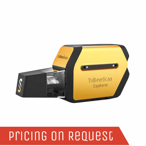
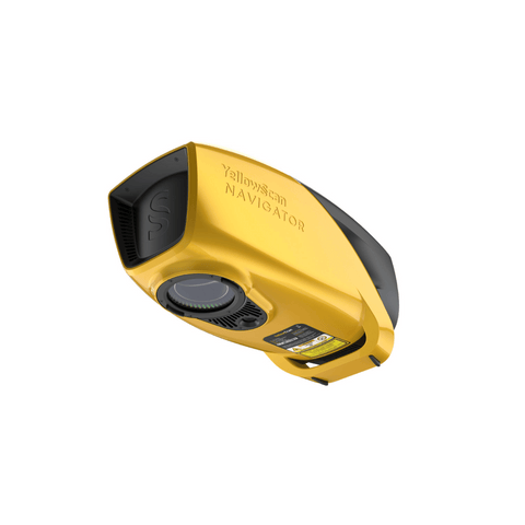
YellowScan's objective with the Explorer, like all of their hardware platforms, is to offer the market a solution that strikes the right balance between size, range, accuracy and weight. Designed to be mounted on fixed-wing UAV, multirotor UAV and manned aircraft (light plane and helicopter). The Explorer can enable a large variety of mission profiles.
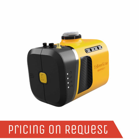
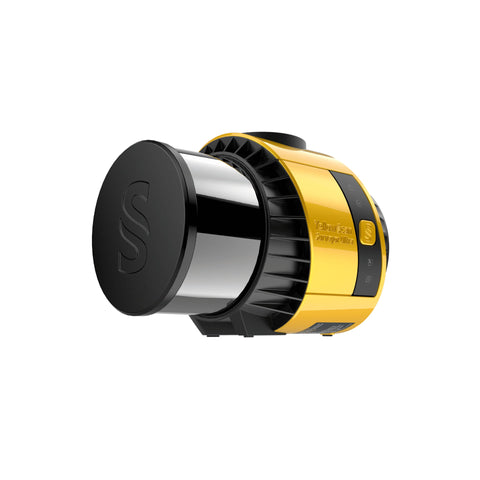
The YellowScan Mapper+ integrates Livox AVIA laser scanner together with high-performance GNSS-aided inertial navigation system into a lightweight, standalone and easy-to-use lidar system. Proven capabilities and stable results
over a wide range of applications.
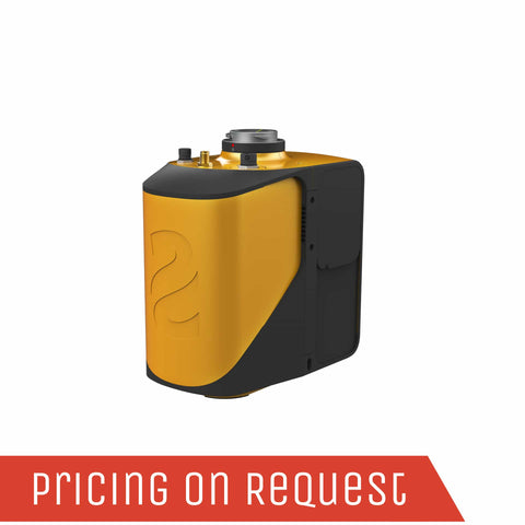
The new YellowScan Mapper is YellowScan's Livox-based UAV LiDAR system. The YellowScan Mapper UAV LiDAR system is equipped with a high-performance Livox Horizon laser scanner from Livox, a DJI-backed company. With a great point density, this LiDAR sensor allows our LiDAR system to fly easily at 70m AGL with a 120m swath.
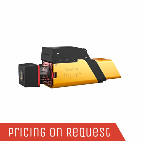
The most accurate and high precision UAV LiDAR solution.
YellowScan Vx20 is the most accurate fully integrated system from YellowScan’s product range. It can fly up to 100m while maintening accuracy throughout the point cloud. The Vx20 series is ideally suited for applications that requires sharp and accurate descriptions.
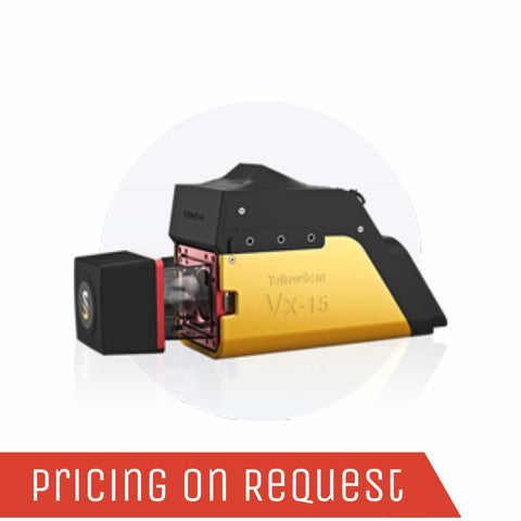
The long range & high precision UAV LiDAR solution. YellowScan Vx15 is the lighest system integrating the Riegl miniVUX.
Following YellowScan’s philosophy « Just press the Yellow Button », YellowScan designed an all-integrated, easy-to-use LiDAR system that includes the renowned Riegl laser scanner and Applanix UAV IMU APX-15. YellowScan Vx15 is an excellent solution for your high flight UAV projects with short-time data processing needs. It is ideally sized for all types of UAVs.
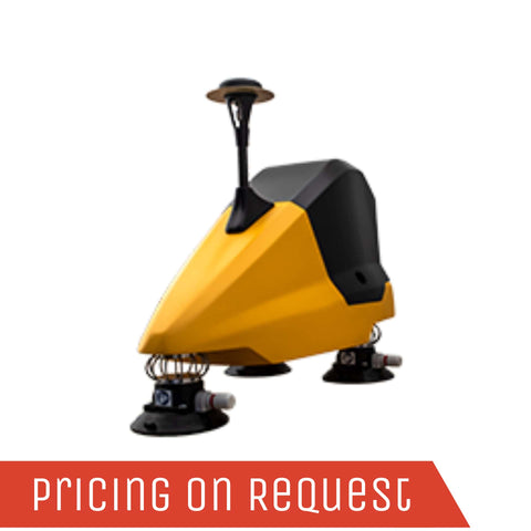
Fly when you can. Drive when you must.
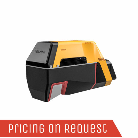
The YellowScan Fly & Drive is a versatile land vehicle-mounted or UAV-mounted mobile mapping system which combines high resolution laser scanning and precise positioning to collect geo-referenced point clouds for a wide range of applications.
Designed to be easily swapped in minutes from vehicles to UAV.
The YellowScan Surveyor Ultra LiDAR system is suited for high speed UAV (VTOL fixed-wing or helicopter) and long-range needs due to its high-density specifications. With the 360° Field of View of the Hesai XT32M2X laser scanner, the YellowScan Surveyor Ultra answers vertical mapping and mobile mapping needs when combined with Fly&Drive. Its light weight makes it easy to mount on any UAV, including VTOL or helicopters. As with all YellowScan LiDAR systems, the Surveyor Ultra is designed for 3D modeling under vegetation, and fast data processing.
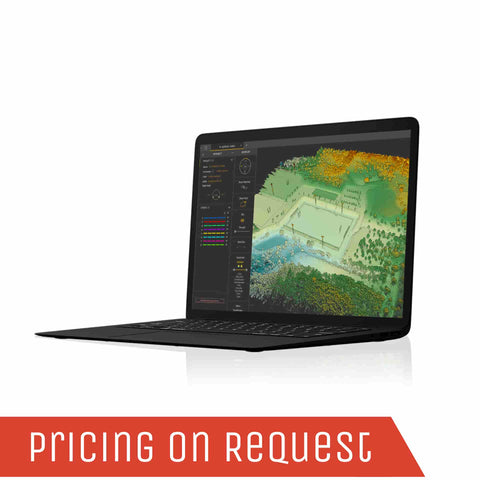
CloudStation is the proprietary software developed by YellowScan to generate and visualize point clouds.
YellowScan CloudStation provides a complete software solution to create and manipulate point cloud data. It allows to extract, process and display data immediately after the acquisition flight. The auto-generation of strips and the production of LAS files are now done in only a few clicks.
Product Comparison
YellowScan's LiDAR for drone product line is lightweight, fully-integrated with embedded batteries. We designed each system to meet 3D mapping high precision and accuracy needs.
The long-range & multi-platform LiDAR solution
|
System Accuracy |
2.6cm |
|
System Precision |
2.2cm |
|
Weight battery excl. |
2.3 kg |
|
Weight battery incl. |
2.6 kg |
|
Typ. flight speed |
5-35m/s |
|
Typ. AGL altitude |
200m |
|
Point density |
110pts/sqm |
|
Max number of echoes |
Up to 5 |
Advanced performance fitted into a compact survey solution
|
System Accuracy |
3cm |
|
System Precision |
2.5cm |
|
Weight battery excl. |
1.1 kg |
|
Weight battery incl. |
1.3 kg |
|
Typ. flight speed |
10m/s |
|
Typ. AGL altitude |
100m |
|
Point density |
700pts/sqm |
|
Max number of echoes |
Up to 3 |
The best cost-performance ratio UAV LiDAR
|
System Accuracy |
3cm |
|
System Precision |
2cm |
|
Weight battery excl. |
1.3 kg |
|
Weight battery incl. |
3.5 kg |
|
Typ. flight speed |
10m/s |
|
Typ. AGL altitude |
70m |
|
Point density |
400pts/sqm |
|
Max number of echoes |
Up to 2 |
The most accurate and high precision UAV LiDAR solution.
|
System Accuracy |
2.5cm |
|
System Precision |
1cm |
|
Weight battery excl. |
2.61 kg |
|
Weight battery incl. |
2.84 kg |
|
Typ. flight speed |
5m/s |
|
Typ. AGL altitude |
100m |
|
Point density |
Up to 150pts/sqm |
|
Max number of echoes |
Up to 5 |
The long range & high precision UAV LiDAR solution. YellowScan Vx15 is the lighest system integrating the Riegl miniVUX.
|
System Accuracy |
5cm |
|
System Precision |
1cm |
|
Weight battery excl. |
2.37 kg |
|
Weight battery incl. |
2.6 kg |
|
Typ. flight speed |
5m/s |
|
Typ. AGL altitude |
100m |
|
Point density |
Up to 150pts/sqm |
|
Max number of echoes |
Up to 5 |
Fly when you can. Drive when you must.
|
System Accuracy |
Up to 5cm |
|
System Precision |
Up to 4cm |
|
Weight battery excl. |
5.43 kg |
|
Weight battery incl. |
5.6 kg |
|
Typ. driving speed |
25-50 km/h |
|
Max range |
100-200m |
|
Point density |
Surveyor or Ultra |
|
Max number of echoes |
Up to 2 |
The new and improved second generation of Surveyor Ultra integrating Hesai’s XT32M2X scanner.
Versatile and long range UAV LiDAR solution.
|
System Accuracy |
3cm |
|
System Precision |
3cm |
|
Weight battery excl. |
1.15 kg |
|
Weight battery incl. |
1.32 kg |
|
Typ. flight speed |
18m/s |
|
Typ. AGL altitude |
90m |
|
Point density |
Up to 250pts/sqm |
|
Max number of echoes |
Up to |
YellowScan UAV LiDAR Systems


Get in Touch
Please complete the form below to submit your quote request.