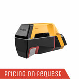
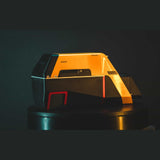
The Voyager is YellowScan's highest range LiDAR solution, with a range of up to 760m. Its laser scanner’s wide field of view of 100° and its extremely fast data acquisition rate of up to 1.8 MHz, makes this solution the best option for projects requiring the highest point density.
YellowScan Voyager UAV Lidar Solution
Where precision meets reality.
AGL Altitude
Up to 440m
System Precision
0.5cm
System Accuracy
1cm
Battery Weight excl.
3.5kg
Key differentiators
- 1.5 million pts/second
- Up to 15 echoes
- Multi-platform
Technologies inside
- RIEGL VUX-120 laser scanner Scanner
- Applanix AP+ 50 AIR
- or Applanix AP+ 30 AIR
Integrations
- Manned aircraft
- Multirotor UAV
- Fixed-wing UAV
Be more productive in the field
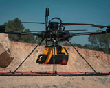
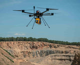
This system can be mounted on light-crewed aircraft, helicopters, or UAV platforms and is our highest range LiDAR solution with a flying height of up to 440m (1440 ft.).
The YellowScan Voyager is a powerful solution for both manned and unmanned aircrafts.
The laser scanner’s specs can be personalized to fit your different project and platform needs.
With its laser scanner’s wide field of view, the entirety of the points are oriented towards the ground, meaning no loss of points.
The Voyager captures 2 million useable points per second, a feature that would be impossible for a 360˚ scanner.
With the 100°scanner, the entirety of the points are oriented towards the ground, meaning no loss of points.
The YellowScan Voyager’s detection and processing of up to 15 target echoes per laser pulse allows for unparalleled vegetation penetration.
Its extremely fast data acquisition rate of up to 1800 kHz, makes this solution the best option for projects requiring the highest point density.
Combined with YellowScan’s full suite of software solutions to easily extract, process, merge, and colorize your pointcloud data.
We offer our users a highly accurate set of tools to also meet the needs of a wide variety of industries.
Vertical Mapping-Ready
Designed for people who require less than 1cm precision and want to efficiently cover complex and vertical targets with ease..
Collect LiDAR and RGB data
The Voyager is compatible with an optional built-in 20 or 60 MP camera module.
Specifications
| General Characteristics | |
|
Precision (1)(3) |
0.5cm |
|
Accuracy (2)(3) |
1cm |
|
Laser scanner |
RIEGL VUX-120 |
|
Laser Pulse Repetition Rate |
Up to 1800 kHz |
|
Echoes per shot |
Up to 15 |
|
Wavelength |
Near infrared |
|
Range |
Up to 760 m |
|
Shots per second |
Up to 240k |
|
Scanner field of view |
100° |
|
GNSS-Inertial solution |
Applanix AP+ 30 AIR or AP+ 50 AIR |
|
Size |
L 36.9 x W 11.7 x H 18.3 cm |
|
Weight batt. excl. |
13.5kg (7.7lbs) |
|
Autonomy |
1 hours typ. |
|
Power consumption |
55W |
|
Operating temperature |
-10 to +40°C |
(1) Precision, also called reproducibility or repeatability, is the degree to which further measurements show the same result.
(2) Accuracy is the degree of conformity of a measured quantity to its actual (true) value.
(3) One sigma @ 150 m range under RIEGL test conditions.
Voyager @1800 kHz PRF
- Platform: Multirotor UAV
- AGL altitude: 80 m AGL
- Speed: 5 m/s
Add-ons
Camera module
High Resolution Camera Module – more information available soon…
Stand-alone mounting bracket
Designed for DJI M600, Acecore Noa or Hexadrone Tundra (more to come).
Related Documents
Get a Quote
Please complete the form below to submit your quote request.


