Cookies are important to the proper functioning of a site and we use them to help us offer you the best online experience. By using our website and/or clicking OK, you are agreeing to our use of cookies in accordance with our cookies policy. I Agree

UgCS Mapper

Tax included.

Please CONTACT US if you are interested in this product.


UcGS Mapper

Versatile 2D map stitching software

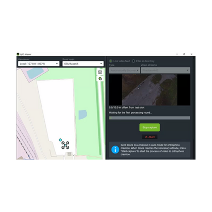
Stitch multispectral and any other aerial images into one orthomosaic or create maps on the fly

UgCS Mapper is an affordable lightweight drone image and video processing software by SPH Engineering to create 2D maps and elevation models.

Main Benefits:

Work offline in the field

UgCS Mapper is capable of working purely offline so that you can quickly stitch the map and validate the quality and density of survey data before leaving the survey area.

Stitch multispectral RGN JPEG

Upload multispectral 3- channel RGN JPEG images of the field into UgCS Mapper for stitching and generate NDVI indexes to assess crop health

Stitch on the fly

When default map sources are not available or obsolete, create up-to-date maps and elevation data on the fly. They are accurate enough for safe mission planning and guiding first response teams.

How it works:

Acquire images/video
Georeferenced JPEG (standard for DJI cameras) or video stream with UgCS ENTERPRISE
Process with UgCS Mapper
Create map and elevation Geotiff
Use Maps
Export to use with UgCS or other GIS software

How to create an orthophoto map from images acquired during the automatic photogrammetry survey with UgCS

Industries

With UgCS Mapper, photogrammetric mapping can be performed almost anywhere and at a more affordable price than ever!

Surveying & Mapping

Solar Energy

Agriculture

Search & Rescue

Mining & Quarrying

Construction

Features

Orthophoto generation

Stitching orthophoto from georeferenced JPG images

Multispectral cameras

Stitch multispectral 3-channel RGN JPEG images to generate NDVI indexes

DSM/elevation data

Generate DSM/elevation data from georeferenced JPG images

Integration

A new map one click away and DSM export from UgCS Mapper into UgCS

Live mapping from the video stream

Combined with UgCS ENTERPRISE license, UgCS Mapper supports LIVE mapping from a drone's video stream

Plan and fly

Plan the survey route with UgCS, perform the one-time calibration on first camera usage and take-off
Plan and fly

Georeferencing

The frames of the video are enriched with georeferenced metadata
Georeferencing

Map preview

During the whole drone's flight UgCS Mapper continuously updates the preview of the map
Map preview

Pricing

As a stand-alone software, UgCS Mapper performs the mapping from drone images.
Choose the licensing model that suits you best!

Subscription

- billed monthly after trial

- support included

- +14-DAY FREE TRIAL

Perpetual

- one-time purchase

- includes 1st year of support*

*For Perpetual

Annual Support & Update pack USD 100/yearly starting 2nd year from purchase

All prices without VAT

Supported OS

The desktop-based image/video stitching software UgCS Mapper can run on:
Customers in 150+ countries use SPH Engineering solutions daily for drone mission planning, flight control, and data management.

SUPPORTED DRONES AND AUTOPILOTS

UgCS currently supports

DJI:

Matrice 600/600 Pro
Matrice 300
Matrice 200/210/210RTK
Matrice 100
Inspire 2
Inspire 1/1 Pro/Raw
Phantom 4 RTK (SDK RC only)
Phantom 4/4 Pro (excluding Agro)
Phantom 3
Mavic Pro/2 series
Spark
A3/N3

Parrot

ANAFI

MAVLink compatible multirotors, fixed wings and VTOLs
Ardupilot
Px4
and other

Autel
EVO II (mission export for Autel Explorer)

Mikrokopter

Micropilot

UGCS SYSTEM REQUIREMENTS

Operating system:

Windows 7 with SP1 or later; Windows 8; Windows 10 / 64-bit

Mac OS X Maverick 10.9 or later / 64-bit

Linux: Ubuntu 18.04 LTS / 64-bit

CPU

Core 2 Duo or Athlon X2 at 2.4 GHz

Memory

Recommended RAM: 4GB or more

Graphics hardware:

Graphics card with DirectX 9 support (shader model 2.0). Any card made since 2004 should work

Hard drive

2 GB of free space

Minimum supported screen resolution: 1024x768

Get a Quote

Please complete the form below to submit your quote request.