

LiDAR Drone Systems: Using LiDAR Equipped UAVs
Everything you need to know about how drone LiDAR is revolutionizing mapping and geospatial data
Drones furnished with cameras provide businesses an additional set of airborne eyes, introducing a fresh outlook on ground-level operations. Across diverse sectors such as construction, emergency services, agriculture, and utilities, drones are contributing significant value.
The sensor technology integrated into unmanned aerial vehicles (UAVs) is in a constant state of evolution, meaning these vehicles are not limited to capturing ordinary images and videos. Among the latest advancements in UAV payloads, there's a notable integration of increasingly advanced Light Detection and Ranging (LiDAR) systems.
Through the deployment of LiDAR-equipped drones, companies can acquire more precise aerial measurements, generating 3D models with accuracy down to centimeters and uncovering details imperceptible to less sophisticated techniques.
LiDAR, far from residing in a specialized technological realm, is extending its influence to various industries that require mapping and geospatial data collection services. Keeping tabs on the latest applications of LiDAR sensor drones can assist in determining their potential alignment with your business's objectives.
What is LiDAR?
LiDAR functions as a remote sensing technology, diverging from traditional photographic cameras. Its sensors emit swift laser pulses and capture the resulting reflections, employing these data points to meticulously and precisely map out an area.
This LiDAR system constructs a point cloud by aggregating data reflections from ground objects. These points serve as the foundational data for crafting 3D models. While the assembly of these models necessitates specialized software and skilled operators, the process itself is notably rapid, yielding high-quality maps with compact file sizes.
However, it's important to note that these 3D renderings lack photographic intricacies. For example, the laser pulses themselves do not convey the colors of ground items. Such color data must be sourced from alternative sensors.
Recent years have witnessed advancements in LiDAR technology, particularly in terms of more affordable and lighter sensor modules. This has spurred the rapid evolution of LiDAR-equipped drone systems, ushering in new models that enable businesses to deploy this technology across a wider array of applications.
Rather than being the product of a single company, LiDAR systems are developed by multiple providers, including Livox and Velodyne. System integrators like GreenValley, YellowScan, Emescent, and LiDARUSA play a pivotal role in transforming these technological components into commercially viable modules.
Given these choices, certain organizations may contemplate incorporating LiDAR into tasks formerly undertaken by other surveying methods like photogrammetry. In other scenarios, enterprises previously reliant on ground-based LiDAR surveying might take to the skies with drone deployments.
Wherever precise surveying and modeling with centimeter-level accuracy are imperative, LiDAR stands as a promising technology. In the coming years, driven by increased accessibility, adoption could extend to novel industries and applications.
LiDAR vs. photogrammetry
What's the difference?
For organizations already employing aerial photogrammetry as their preferred surveying and mapping technique, the question arises whether transitioning to LiDAR would yield additional benefits. To begin, it's essential to outline the concept of photogrammetry and elucidate its potential applications and limitations.
Photogrammetry involves employing a multitude of photographs to ascertain distances. Photogrammetry-equipped drones traverse landscapes or structures, capturing images that are subsequently synthesized into 2D or 3D models through software. These models find utility in construction, agriculture, mining, and other sectors necessitating frequent mapping.
In comparison to LiDAR, photogrammetry systems might encounter challenges in discerning very minute and intricately detailed objects. For instance, while LiDAR pulses can detect power lines, the photographs captured by photogrammetry devices might overlook the presence of wires. Additionally, LiDAR possesses the ability to penetrate foliage, capturing the contours of the underlying terrain, and it remains effective even in low-light conditions.
Historically, the main rationale behind opting for photogrammetry has been its relative accessibility. With the advent of lighter and more cost-effective modules, it has become the preferred choice for companies that don't require the heightened precision afforded by LiDAR data. Moreover, the software used to generate point clouds from raw photogrammetry data is more prevalent and widely utilized compared to its LiDAR counterpart.
As the costs and weight of LiDAR continue to decrease, the dynamics might shift for some of these enterprises, potentially encouraging a more widespread adoption of LiDAR technology. Furthermore, there exists the possibility of integrating drone LiDAR alongside other mapping methodologies to produce more comprehensive models overall. This proves especially crucial in scenarios where the final output demands photorealism, as LiDAR pulses, as previously noted, do not capture the colors of objects.
Why use a LiDAR drone?
Employing a LiDAR-equipped drone presents a swift and secure means of swiftly acquiring data pertaining to diverse terrestrial sites or features. This encompasses a wide spectrum of applications, ranging from safety inspections to monitoring mining or agricultural progress, and even gauging resource stockpile dimensions from an aerial perspective.
For enterprises operating fleets of LiDAR drones, generating precise 3D models of landscapes and structures becomes effortless. These models can be periodically updated, such as to monitor the advancement of a construction project and compare it against original plans and blueprints.
LiDAR technology facilitates scenarios that might have previously demanded an excessive level of precision beyond what photogrammetry systems could provide. For instance, operators can now map out power lines and meticulously reconstruct accident scenes using the intricate 3D point clouds produced by LiDAR modules.
There are instances, however, where companies won't opt to replace photogrammetry with LiDAR, but rather, they'll leverage both solutions concurrently to ensure they always possess the most suitable sensor for the task at hand. This approach is increasingly feasible as organizations invest in versatile, adept drone platforms capable of accommodating multiple sensor modules.
LiDAR drones vs. ground-based LiDAR
When making the decision about integrating LiDAR drone systems, company leaders must also consider whether ground-based LiDAR modules might offer superior advantages. These terrestrial options, available from providers such as Faro and Trimble, boast exceptional accuracy, achieving scanning at millimeter-level precision.
However, the drawback of employing ground-based LiDAR lies in its efficiency. Utilizing a drone to traverse a site enables surveyors to accomplish more tasks within a shorter timeframe, while also accessing challenging or inaccessible areas. In contrast, operating ground-based laser scanners can at times be a cumbersome process.
As long as an organization can accept an accuracy range of approximately +/- 5cm when generating 3D models from point clouds, the utilization of aerial sensors mounted on LiDAR drones presents a significantly more efficient strategy for mapping and surveying endeavors.
Case study: Cooling tower inspection
In advance of a reactor cooling tower demolition in France, the demolition firm needed to create accurate 3D models so that the process could be carried out precisely and accurately. Traditional inspection methods would be unsafe due to the presence of asbestos in paint on the towers. Furthermore, the job's timeline was tight, meaning the surveying would have to be carried out in the evenings.
Faced with these challenging conditions, the team used both photogrammetry and LiDAR drones to create 3D models of the towers. While much of the daytime work was carried out with photogrammetry, LiDAR was brought in for evening and dusk work, outputting 3D point clouds that quickly became detailed 3D models.
Read the full study to learn more about how UAV LiDAR functions on the job site.
LiDAR drones applications
Incorporating LiDAR-equipped UAVs offers a remarkable solution for companies across diverse sectors to enhance their mapping and surveying capabilities. The versatility of drone LiDAR technology is truly striking, encompassing a multitude of distinctive deployment scenarios. Certain instances even blend photogrammetry with LiDAR, while others originate entirely anew, catalyzed by the accessibility of cost-effective LiDAR drones.
Land surveying for small plots
When precision is required for conducting an aerial survey of a land parcel, a LiDAR drone emerges as the optimal solution. While expansive areas might necessitate aerial coverage through planes or manned helicopters, drone technology proves exceptionally well-suited for smaller plots.
Easily construct accurate terrain maps to make informed landscaping decisions. Image by LiDARUSA
Employing a drone for surveying purposes is notably cost-effective compared to the expenses associated with operating, staffing, and fueling a conventional aircraft. Additionally, drones operate using compact UAVs, eliminating the need for on-site piloting and enhancing safety. With just a few ground-based operators, the area can be efficiently and systematically mapped, allowing for swift progression to subsequent tasks.
Topographic and bathymetric surveying
In addition to smaller surveys, LiDAR drones can use sensors to take in large topographical areas, taking over work that would traditionally be carried out from planes or helicopters. In the case of a land-based survey, the drone uses a near-infrared laser.
By flying over the water and using a water-penetrating green light, LiDAR drones can also collect readings about the depth of the sea floor or riverbed in a given area. When creating maps that incorporate bathymetric data, LiDAR drones can cover both the land and the sea.
Digital terrain modeling in advance of work
As companies gear up for substantial earthmoving endeavors, possessing a comprehensive 3D map of the site becomes imperative. This is precisely where a precise digital terrain model (DTM), crafted through a LiDAR-derived 3D point cloud, can play a crucial role.
True-color point cloud captured by the Zenmuse L1
Earth excavation costs are typically calculated based on the volume of soil displaced per cubic yard. Consequently, for effective budgetary projections, enterprises must possess precise insights into the terrain within a designated region, facilitated by 3D imagery. LiDAR possesses the capability to penetrate through vegetation and other elements, providing precise assessments of the topographical characteristics of a specific site.
Accident scene mapping and reconstruction
Drones are gaining increased prominence across various public safety applications. For instance, thermal-equipped drones prove valuable in locating missing individuals, even during nighttime hours. In scenarios involving LiDAR drones, the technology is especially well-suited for intricate accident scene reconstruction. Such tasks can be undertaken round the clock, as LiDAR operates independently of ambient lighting conditions.
Collision reconstruction in low-light conditions with LiDAR
After the highly accurate 3D model is captured, crews can clear the wreck scene. This timeliness is especially important when an accident site is obstructing traffic. The data from the LiDAR drone can then serve as evidence in any court cases stemming from the crash. Please note that photogrammetry is also an excellent option for crash scene reconstruction and emergency mapping, which you can learn more about in our Emergency Mapping Guidebook below.
Forestry
Assessing the inventory of a forest utilized for syrup, paper, or lumber production can prove challenging and time-intensive due to the extensive expanses involved. Entities not utilizing LiDAR drones might find themselves dependent on approximations derived from workers' estimations.
LiDAR can measure canopy heights and tree density
A LiDAR-equipped drone has the capability to provide precise measurements of various metrics, including canopy height and tree density. The sensors employed are so refined that they can yield data about individual trees. Moreover, LiDAR drones are adept at operating under low-light conditions when visibility is restricted.
Precision agriculture
In recent years, the adoption of data-driven agricultural methods has gained momentum, aided by photography drones that contribute to tasks ranging from crop strategizing to livestock monitoring. The introduction of LiDAR drones can elevate the precision of projections, enabling farmers to make responsive decisions based on field conditions.
A significant application of LiDAR drones in agriculture involves furnishing 3D terrain information, empowering operators to establish levees in their rice fields. Another notable utility is gauging crop advancement, empowering farmers to optimize fertilizer application with heightened accuracy.
Power line inspection
While utility operators may have struggled to measure small infrastructure components (including power lines) before the advent of affordable UAV LiDAR systems, they can now carry out aerial inspections. Scanning power lines from the air allows surveyors to measure risk factors, such as the encroachment of vegetation.
Whether gathering data on the present state of power grid infrastructure or strategizing the construction of new power lines, utility providers can depend on 3D models generated by LiDAR-equipped drones. The aerial nature of these vehicles facilitates smoother and safer navigation across challenging terrains.
Mining
Mining corporations have the capability to gauge the extent of ore extraction within their mines. Through the analysis of surface data and the juxtaposition of current and past measurements, miners can ascertain the progress of their operations. Drones offer a cost-effective alternative compared to aerial surveys via airplanes, providing heightened safety and efficiency compared to ground-based scanning methods.
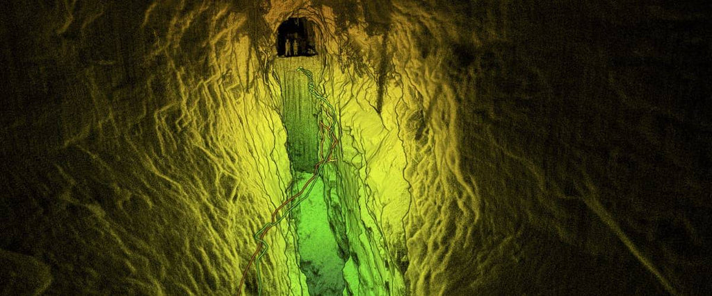
Employing drones within mining environments is an additional valuable approach to data collection that places a strong emphasis on safety. SLAM LiDAR can function as a collision detection mechanism, enabling drones to navigate and map interior spaces of mines. Post a planned detonation, a drone can enter a shaft as a preliminary measure, confirming the structural integrity for subsequent human entry.
Matrice 300 RTK with an Emesent Hovermap
Archaeology
LiDAR-equipped drones excel at meticulously mapping the precise outlines of structures — and these structures need not be modern constructs. When applied to an archaeological site, UAVs empower researchers to gain a comprehensive understanding of the dimensions and relative positioning of pertinent landscape attributes, including human-made remnants.
The process of mapping an archaeological site with a LiDAR-equipped UAV is notably expedient and streamlined when contrasted with ground-based scanning and mapping techniques. Given the drones' capacity to traverse extensive areas, archaeologists can efficiently rediscover entire sections that had been "lost" over time, even encompassing complete ancient cities, all within a concise timeframe.
Stockpile volume measurements
Construction companies are extending their applications beyond mere surveying by incorporating these systems into other functions, including inventory assessment. Employing repeated scans of material stockpiles enables businesses to calculate consumption rates, facilitating well-timed reordering.
A comprehensive grasp of every facet of a construction site translates to enhanced overall operational efficiency. The capacity to monitor fluctuations in stockpile volume over time is feasible with accurate sensors like LiDAR. Employing drones as a platform for mounting such sensors proves to be a streamlined and effective strategy for implementing these solutions.