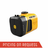
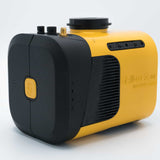
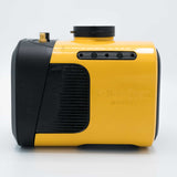
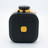
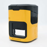
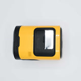
The YellowScan Mapper+ integrates Livox AVIA laser scanner together with high-performance GNSS-aided inertial navigation system into a lightweight, standalone and easy-to-use lidar system. Proven capabilities and stable results
over a wide range of applications.
Proven capabilities and stable results over a wide range of applications.
YellowScan's Mapper+ can be mounted on a wide range of UAV platforms due to its low weight.
YellowScan Mapper+ UAV Lidar Solution
Advanced performance fitted into a compact survey solution.
AGL Altitude
100m
System Precision
2.5cm
System Accuracy
3cm
Battery Weight excl.
1.1kg
Why the Mapper+?
Applanix Inertial and Navigation solution
- Stable, performing and proven result
- GNSS-INS post-processing software
CloudStation processing software included
- Terrain classification
- Strip adjustment
Customer Support
- Worldwide support by field operation experts
Advanced YellowScan calibration
- Improved scanner performance
Versatile
- Can be used on any UAV
- Compatible with DJI Skyport & Gremsy port
Key differentiators
- High density
- Compact & lightweight
- 100 m typ. flying height
Technologies inside
- Livox AVIA laser scanner
- Applanix APX-15 UAV IMU
Integrations
- Helicopter drones
- Multirotor drones
- Fixed-wing UAV
Colorize your point cloud using the Camera Module extension.
You can now use our very own camera module on the YellowScan Mapper+.
Operating the camera will be as simple as what philosophy indicates: “Just press the Yellow button”. The camera is powered through the Mapper+ and its data is stored on a dedicated SD card.
Carry your YellowScan Mapper+ on a dedicated backpack.
In this hardshell backpack with custom precut foam, you can easily carry your LiDAR with everything you need (LiDAR system, software, batteries, laptop, data storage). This backpack is the size of a carry-on luggage which fits in any airline overhead compartment.
You‘ve got the power! A set of 2 worldwide certified batteries is shipped with the YellowScan Mapper+.
They are high-performance batteries that can easily be swapped in the field for increased productivity.
You have 3 different ways to power your YellowScan Mapper+. You can either use:
- Skyport (on DJI M300 UAV) or Gremsy port
- External Power source with the dedicated port (UAV’s power)
- YellowScan Mapper+ LiDAR system’s own power
Just land, remove the first battery set and replace it by the new one. Take-off again! The YellowScan Mapper+ has 1h autonomy with its own battery.
Connect your Mapper LiDAR system to your DJI Skyport.
The YellowScan Mapper+ can be used with the DJI Skyport. The Mapper+ is compatible with the DJI M300…but not only. We have a bunch of customers flying their UAV with our product: multirotor, fixed-wing and helicopter drones.
Connect your YellowScan Mapper+ LiDAR system with Gremsy Port.
The YellowScan Mapper+ is also compatible with the Gremsy port for quick release and easy integration on a wide range of UAVs.
-
HMI
-
Data Storage
-
Airflow
-
Dual-sensor
The Human-Machine Interface was thought out to be simple and efficient
With LEDs that indicate the LiDAR system’s status and its single button operation. As usual, we followed the “Just Press the Yellow Button” philosophy.
Data storage is not an issue.
You don’t need to connect to your LiDAR system to gather data. Just remove the USB stick from the system and go to your computer. As you receive two USBs, this helps you land and take-off again straight away thanks to the second USB stick.
Survey productivity matters to us! With one USB stick you can store LiDAR data from a 3 hour-survey.
.
No overheating LiDAR system!
We have optimized the temperature management with a double suction grid (air flow management) for a better aeration of the system. You can operate the Mapper+ between -20°C/-4°F and +40°C/140°F.
You said dual-sensor?
We designed a new unique internal port for RGB cameras. You will be able to connect other sensors, if needed.
Specifications
| General Characteristics | |
|
Precision (1) |
2.5cm |
|
Accuracy (2) |
3cm |
|
Echoes per shot |
Up to 3 |
|
Laser wavelength |
905nm |
|
GNSS-Inertial solution |
Applanix APX-15UAV |
|
Scanner field of view |
70.4° |
|
Shots per second |
Up to 240k |
|
Weight batt. incl. |
1.3kg (2.9lbs) |
|
Weight batt. excl. |
1.1kg (2.5lbs) |
|
Size |
L15cm x W10.4cm x H12.3cm |
|
Autonomy |
1 hours typ. |
|
Power consumption |
19W |
|
Operating temperature |
-20 to +40°C |
(1) Precision is considered as the mean value of absolute elevation differences between 2 flight lines recorded in opposite directions over a nadir-located 40 m² hard surface area. Here, precision was obtained by averaging the result from 3 flight levels @60, 90 and 120 m AGL.
(2) Accuracy is considered as the RMSE value of the elevation differences between targets and lidar points extracted from 2 flight lines recorded in opposite directions. Here, accuracy was obtained by averaging the accuracy from 3 flight levels @ 60, 90 and 120 m AGL. Targets are located within a 40 m wide corridor centered along the flight line axis.
Related Documents
Get a Quote
Please complete the form below to submit your quote request.


