Cookies are important to the proper functioning of a site and we use them to help us offer you the best online experience. By using our website and/or clicking OK, you are agreeing to our use of cookies in accordance with our cookies policy. I Agree

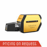
YellowScan Explorer

  • Sale
  • Regular price R 0.00
Tax included.

Please CONTACT US if you are interested in this product.


YellowScan Explorer UAV Lidar Solution

Long-range & multi-platform LiDAR solution.

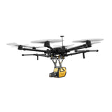
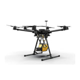
YellowScan's objective with Explorer, like all of their hardware platforms, is to offer the market a solution that strikes the right balance between size, range, accuracy and weight. Designed to be mounted on fixed-wing UAV, multirotor UAV and manned aircraft (light plane and helicopter). The Explorer can enable a large variety of mission profiles.

Combined with 1-year unlimited technical support and training, our users will be ready to take full advantage of Explorer’s functionality and successfully complete their surveying projects.

The Explorer is the fruit of several years of research and learning that YellowScan has gathered working with our customers and partners around the world.


The new YellowScan Explorer can be mounted on a light manned aircraft or switched to different types of UAV platforms.

AGL Altitude

300m

System Precision

2.6cm

System Accuracy

2.2cm

Battery Weight excl.

2.3kg


Key differentiators

  • Longest range
  • Compact & lightweight
  • Multi-platform

Technologies inside

  • Co-developped Laser Scanner
  • Applanix APX-20 IMU

Integrations

  • Manned aircraft
  • Multirotor UAV
  • Fixed-wing UAV

Explorer @500 kHz PRF

  • Platform: Multirotor UAV
  • AGL altitude: 100 m
  • Speed: 10 m/s

Explorer @500 kHz PRF

    • • Platform: VTOL
      • AGL altitude: 120 m
      • Speed: 15 m/s
     

Explorer @400 kHz PRF

  • Platform: Ultralight Manned Aircraft
  • AGL altitude: 200 m
  • Speed: 35 m/s

The Human-Machine Interface was thought out to be simple and efficient

With LEDs that indicate the LiDAR system’s status and its single button operation. As usual, we followed the “Just Press the Yellow Button” philosophy.

Data storage is not an issue.

You don’t need to connect to your LiDAR system to gather data. Just remove the USB stick from the system and go to your computer. As you receive two USBs, this helps you land and take-off again straight away thanks to the second USB stick.

Survey productivity matters to us! With one USB stick you can store LiDAR data from a 6 hour-survey.

.

No overheating LiDAR system!

We have optimized the temperature management with four suction grids (air flow management) combined with an innovative heat management inside for a better aeration of the system. You can operate the Explorer between -20°C/-4°F and +40°C/104°F.

You‘ve got the power!

A set of 2 worldwide certified batteries is shipped with the YellowScan Explorer.
They are high-performance batteries that can easily be swapped in the field for increased productivity.


Specifications

General Characteristics

Precision (1)

2.6cm

Accuracy (2)

2.2cm

Echoes per shot

Up to 5

Laser wavelength

1556nm

Range

Up to 600m

GNSS-Inertial solution

Applanix APX-20UAV

Scanner field of view

360°

Shots per second

Up to 500k

Scanning frenquency

165 Hz

Weight batt. incl.

2.6kg (5.7lbs)

Weight batt. excl.

2.3kg (5.1lbs)

Size

L32.8cm x W12.2cm x H15.6cm

Autonomy

1.3 hours typ.

Power consumption

50W

Operating temperature

-20 to +40°C

(1) Precision is considered as the mean value of absolute elevation differences between 2 flight lines recorded in opposite directions over a nadir-located 40 m² hard surface area. Here, precision was obtained by averaging the result from 3 flight levels @60, 90 and 120 m AGL.

(2) Accuracy is considered as the RMSE value of the elevation differences between targets and lidar points extracted from 2 flight lines recorded in opposite directions. Here, accuracy was obtained by averaging the accuracy from 3 flight levels @ 60, 90 and 120 m AGL. Targets are located within a 40 m wide corridor centered along the flight line axis.


Get a Quote

Please complete the form below to submit your quote request.