Cookies are important to the proper functioning of a site and we use them to help us offer you the best online experience. By using our website and/or clicking OK, you are agreeing to our use of cookies in accordance with our cookies policy. I Agree

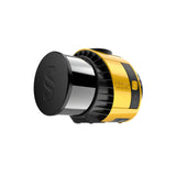
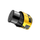
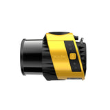
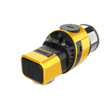
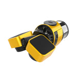
YellowScan Surveyor Ultra

Tax included.

Please CONTACT US if you are interested in this product.


YellowScan Surveyor Ultra UAV Lidar Solution

The new and improved second generation of Surveyor Ultra integrating Hesai’s XT32M2X scanner.

With its 360° field of view, the YellowScan Surveyor Ultra answers vertical mapping and mobile mapping needs when combined with Fly&Drive. Expect unparalleled vegetation penetration thanks to this system’s 32 laser beams.


Compatible with:
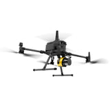
DJI Matrice 350 RTk 
DJI Matrice 300 RTK
DJI Matrice 600
DJI Matrice 210 RTK
DJI Matrice 200


YellowScan Surveyor Ultra is a Hesai XT32M2X-based UAV LiDAR system.

AGL Altitude

140m

System Precision

3cm

System Accuracy

2.5cm

Weight

0.98kg

Key differentiators

  • Suitable for mobile mapping (YellowScan Fly&Drive)
  • 360° Field of View, ideal for vertical mapping
  • Turn-key, simple to operate and self-powered
  • Can be mounted quickly on any UAV
  • High point-density
  • Lightweight

Technologies inside

  • Hesai XT32M2X Laser Scanner
  • Applanix APX-15 IMU
  • High-performance GNSS antenna

Integrations

  • Multirotor UAV
  • Fixed-wing UAV
  • Land vehicles
YellowScan Surveyor Ultra Specifications

Precision

3 cm

Accuracy

2.5cm

Typ. flight speed

10 m/s

Max. AGL altitude

140 m

Laser range

Up to 300m

Laser scanner

Hesai XT32M2X

GNSS-Inertial solution

SBG Quanta Micro

Scanner field-of-view

360° x 40.3°

Eches per second

Up to 3

Shots per second

Up to 640 000

Scanning frequency

Up to 20 Hz

Integrated Camera

Global Shutter

Weight

0.98 kg (2.2 lbs) batt. excl.

Size

L 153 x W 113 x H 117 mm

Autonomy

1.2 hour typ.

Power consumption

20 W

Operating temperature

-10 to +40°C

Easy integration into UAV platforms

This system can be used on multirotor, fixed-wing VTOL and helicopter UAVs. This flexibility is an asset if you have a great diversity of missions: sizes and reliefs. Fixed-wing VTOL for big areas to survey, multirotor for small areas or vertical sections. When it comes to drones, the “quick release” attachment allows for easy mounting on a wide range of drones. Two options: Gremsy or Skyport, which can be interchanged depending on the drone you’re using.


Features

360° field of view: vertical mapping-ready

The Surveyor Ultra allows for the collection of LiDAR data not only from the ground, but for verticals as well. It is the best option for applications such as vertical inspections (buildings, bridges, coastal erosion, cliffs, mountains).


Turn-key, simple to operate & self-powered

As with all YellowScan LiDAR systems, the Surveyor Ultra follows the “Just Press the Yellow Button” philosophy. It is designed for 3D modeling under vegetation and fast data processing.

Embedded camera

You have the ability to scan at 360° with the YellowScan Surveyor Ultra. This means you can collect LiDAR data not only from the ground but for verticals as well.

The Surveyor Ultra is your best option if you plan to use your LiDAR system for applications such as vertical inspections (buildings, bridges, coastal erosion, cliffs, mountains). And you benefit from a high point density obtained from the Hesai XT32M2X laser scanner.

Collect LiDAR and RGB data

The Surveyor Ultra is compatible with an optional 20MP or 60MP single-camera module, or a 35MP dual-camera modul


Data generation in a few clicks

We designed an aluminium cooling plate and air flow management system with internal fan. This system increase longevity and reliability of the components integrated into the LiDAR system.Handle your pointclouds with our own, all-in-one software solution. Extract, process, and display data immediately after flight acquisition.

Make your life easier

Invest in productivity-enhancing features that will simplify your workflow and give you confidence in the deliverables produced for your projects.


Get a Quote

Please complete the form below to submit your quote request.