Cookies are important to the proper functioning of a site and we use them to help us offer you the best online experience. By using our website and/or clicking OK, you are agreeing to our use of cookies in accordance with our cookies policy. I Agree

YellowScan Vx15

Tax included.

Please CONTACT US if you are interested in this product.


YellowScan Vx15 UAV LiDAR Series

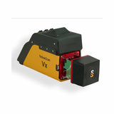
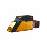
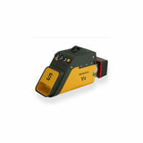
The long range & high precision UAV LiDAR solution. YellowScan Vx15 is the lighest system integrating the Riegl miniVUX.

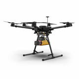
Following YellowScan’s philosophy « Just press the Yellow Button », YellowScan designed an all-integrated, easy-to-use LiDAR system that includes the renowned Riegl laser scanner and Applanix UAV IMU APX-15. YellowScan Vx15 is an excellent solution for your high flight UAV projects with short-time data processing needs. It is ideally sized for all types of UAVs.


Having a longer range and more accurate system were the prerequisites of the Vx-series.

Max Altitude

100m

System Precision

1cm

System Accuracy

5cm

Battery Weight excl.

2.6kg

Vx15-100

  • Scanner: RIEGL miniVUX-1UAV
  • Laser pulse: 100kHz

Vx15-200

  • Scanner: RIEGL miniVUX-2UAV
  • Laser pulse: 100kHz / 200kHz

Vx15-300

  • Scanner: RIEGL miniVUX-3UAV
  • Laser pulse: 100kHz / 200kHz / 300kHz

Key differentiators

  • High precision point cloud
  • Maximized range
  • Calibrated intensity value

Technologies inside

  • Applanix
  • Riegl

Integrations

  • Helicopter Drones
  • Multirotor Drones
  •  

General Specifications

General Characteristics

Precision

1cm

Accuracy

5cm

Echoes per shot

Up to 5

Laser wavelength

905nm

GNSS-Inertial solution

Applanix APX-15UAV

Weight

2.6kg (5.7lbs) battery included

Size

L35 x W11 x H17cm

Autonomy

1.5 hours typ.

Power consumption

25W

Operating temperature

-20 to +40°C

Vx20-100

100kH

Shots per second

100k over 360°

Scanner field of view

360°

Operating Flight Altitude AGL natural targets > 20%

100m

Average point density @50m AGL, 5m/s, 90° FOV

50pts/sqm

Vx20-200

100kH 200kHz over 360°

Shots per second

100k over 360°

200k over 360°

Scanner field of view

360°

360°

Operating Flight Altitude AGL natural targets > 20%

100m

85m

Average point density @50m AGL, 5m/s, 90° FOV

50pts/sqm

100pts/sqm

Vx20-300

100kH 200kHz over 360° 200kHz over 180° 300kHz

Shots per second

100k over 360°

200k over 360°

100k over 180°

100k over 120°

Scanner field of view

360°

360°

180°

120°

Operating Flight Altitude AGL natural targets > 20%

100m

85m

100m

100m

Average point density @50m AGL, 5m/s, 90° FOV

50pts/sqm

100pts/sqm

100pts/sqm

150pts/sqm


Related Documents

Get a Quote

Please complete the form below to submit your quote request.