Cookies are important to the proper functioning of a site and we use them to help us offer you the best online experience. By using our website and/or clicking OK, you are agreeing to our use of cookies in accordance with our cookies policy. I Agree

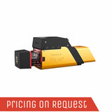
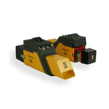
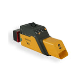
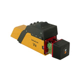
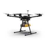
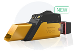
YellowScan Vx20

  • Sale
  • Regular price R 0.00
Tax included.

Please CONTACT US if you are interested in this product.


YellowScan Vx20 UAV LiDAR Series

The most accurate and high precision UAV LiDAR solution

YellowScan Vx20 is the most accurate fully integrated system from YellowScan’s product range. It can fly up to 100m while maintening accuracy throughout the point cloud. The Vx20 series is ideally suited for applications that requires sharp and accurate descriptions.


Having a longer range and more accurate system were the prerequisites of the Vx-series.

AGL Altitude

100m

System Precision

1cm

System Accuracy

2.5cm

Battery Weight excl.

2.84kg

Vx20-100

  • Scanner: RIEGL miniVUX-1UAV
  • Laser pulse: 100kHz

Vx20-200

  • Scanner: RIEGL miniVUX-2UAV
  • Laser pulse: 100kHz / 200kHz

Vx20-300

  • Scanner: RIEGL miniVUX-3UAV
  • Laser pulse: 100kHz / 200kHz / 300kHz

Key differentiators

  • High precision point cloud
  • Maximized range
  • Calibrated intensity value
  • Highest accuracy

Technologies inside

  • Applanix
  • Riegl

Integrations

  • Manned aircraft
  • Multirotor UAV
  • Fixed-wing UAV

General Specifications

General Characteristics

Precision (1)

2.6cm

Accuracy (2)

2.2cm

Echoes per shot

Up to 5

Laser wavelength

905nm

GNSS-Inertial solution

Applanix APX-200UAV

Weight

2.84kg (6.25lbs) battery included

Size

L35 x W11 x H17cm

Autonomy

1.5 hours typ.

Power consumption

25W

Operating temperature

-20 to +40°C

Vx20-100

100kH

Shots per second

100k over 360°

Scanner field of view

360°

Operating Flight Altitude AGL natural targets > 20%

100m

Average point density @50m AGL, 5m/s, 90° FOV

50pts/sqm

Vx20-200

100kH 200kHz over 360°

Shots per second

100k over 360°

200k over 360°

Scanner field of view

360°

360°

Operating Flight Altitude AGL natural targets > 20%

100m

85m

Average point density @50m AGL, 5m/s, 90° FOV

50pts/sqm

100pts/sqm

Vx20-300

100kH 200kHz over 360° 200kHz over 180° 300kHz

Shots per second

100k over 360°

200k over 360°

100k over 180°

100k over 120°

Scanner field of view

360°

360°

180°

120°

Operating Flight Altitude AGL natural targets > 20%

100m

85m

100m

100m

Average point density @50m AGL, 5m/s, 90° FOV

50pts/sqm

100pts/sqm

100pts/sqm

150pts/sqm


Related Documents

Get a Quote

Please complete the form below to submit your quote request.