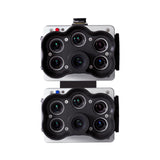
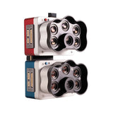
High-resolution multispectral and RGB composite drone sensor for plants classification, weeds identification, environmental research and conservation, and vegetation analysis of water bodies.
The dual solution features the RedEdge-P and the new RedEdge-P blue cameras.
NDAA compliant.
Micasense RedEdge-P Dual Key Features
- 10 multispectral bands at 1.6 MP each.
- Pan-sharpening technology for spatial resolution of 2 cm / 0.8 in per pixel compared to satellites at ~10 m / 32 ft.
- Coastal blue band for water vegetation analysis and weeds identification.
- Double radiometric calibration with light sensor and calibration reflectance panel for reliable data in varying light conditions.
- Global shutter on all 10 lenses for distortion-free image capture.
- Narrow bands for enhanced data accuracy.
- Fast capture rate: 3 raw DNG images per second.
- Synchronized capture of all 10-bands, automatic triggering and geotagging of images for efficient flight times easy post-processing.


