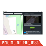
Stitch multispectral and any other aerial images into one orthomosaic or create maps on the fly
UcGS Mapper
Versatile 2D map stitching software
Main Benefits:
Work offline in the field
Stitch multispectral RGN JPEG
Stitch on the fly
How it works:
How to create an orthophoto map from images acquired during the automatic photogrammetry survey with UgCS
Industries
Surveying & Mapping
Solar Energy
Agriculture
Search & Rescue
Mining & Quarrying
Construction
Features
Orthophoto generation
Multispectral cameras
DSM/elevation data
Integration
Live mapping from the video stream
Plan and fly
Georeferencing
Map preview
Pricing
Choose the licensing model that suits you best!
Subscription
- billed monthly after trial
- support included
- +14-DAY FREE TRIAL
Perpetual
- one-time purchase
- includes 1st year of support*
*For Perpetual
Annual Support & Update pack USD 100/yearly starting 2nd year from purchase
Supported OS
SUPPORTED DRONES AND AUTOPILOTS
UgCS currently supports
DJI:
Matrice 600/600 Pro
Matrice 300
Matrice 200/210/210RTK
Matrice 100
Inspire 2
Inspire 1/1 Pro/Raw
Phantom 4 RTK (SDK RC only)
Phantom 4/4 Pro (excluding Agro)
Phantom 3
Mavic Pro/2 series
Spark
A3/N3
Parrot
ANAFI
MAVLink compatible multirotors, fixed wings and VTOLs
Ardupilot
Px4
and other
Autel
EVO II (mission export for Autel Explorer)
Mikrokopter
Micropilot
UGCS SYSTEM REQUIREMENTS
Operating system:
Windows 7 with SP1 or later; Windows 8; Windows 10 / 64-bit
Mac OS X Maverick 10.9 or later / 64-bit
Linux: Ubuntu 18.04 LTS / 64-bit
CPU
Core 2 Duo or Athlon X2 at 2.4 GHz
Memory
Recommended RAM: 4GB or more
Graphics hardware:
Graphics card with DirectX 9 support (shader model 2.0). Any card made since 2004 should work
Hard drive
2 GB of free space
Minimum supported screen resolution: 1024x768
Get a Quote
Please complete the form below to submit your quote request.


