
News RSS
Achieve Compliance & Operational Success for DJI Dock 3


Top 9 Features of DJI Dock 3


Top Features of the DJI Matrice 4 Series


Redefining Aerial Operations The DJI Matrice 4 Series sets a new benchmark for enterprise drones, combining advanced AI, enhanced safety features, and unparalleled precision. This compact, multi-sensor drone series includes two models—the Matrice 4T and Matrice 4E—each purpose-built to meet the demands of diverse industries. From public safety and surveying to construction, the Matrice 4 Series streamlines workflows and delivers professional-grade results with ease. Discover how the Matrice 4 Series is revolutionizing aerial operations by offering cutting-edge features that cater to the unique needs of professionals across various fields. Powerful Multi-Sensor Systems The Matrice 4T and 4E are equipped with...
Top Features of DJI Dock 2


Easy Operation, Superior Results Introducing DJI Dock 2, a groundbreaking advancement in remote drone operations. Building upon the success of its predecessor, Dock 2 introduces a host of unique features and capabilities poised to revolutionize emergency response, construction management, surveying, and asset inspection. It serves as the ultimate solution for enterprises seeking unparalleled performance in their remote drone operations. As DJI continues to innovate in drone technology, with new drones and payloads regularly introduced, their commitment remains steadfast in enhancing their products and optimizing their functionality for users. Before making an investment in a drone, enterprises should carefully consider key...
Top Features of DJI Modify
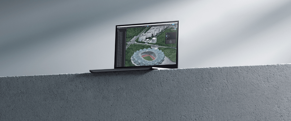

Here are the top features of DJI Enterprise's new 3D model editing software For over ten years, DJI has been synonymous with cutting-edge drone technology, particularly in the commercial drone sector through DJI Enterprise. In recent times, DJI Enterprise has further enhanced its software offerings, introducing the cloud-based fleet and mission management platform, Flighthub 2, and continuously upgrading its UAV 3D modeling software, DJI Terra. Now, DJI unveils another milestone in its commitment to providing comprehensive solutions for professional survey users. Introducing DJI Modify, the latest innovation poised to revolutionize 3D model editing and reshape the industry landscape. Introducing DJI...