Cookies are important to the proper functioning of a site and we use them to help us offer you the best online experience. By using our website and/or clicking OK, you are agreeing to our use of cookies in accordance with our cookies policy. I Agree

DJI Mavic 3 Enterprise Survey Bundle

Tax included.

Please CONTACT US if you are interested in this product.


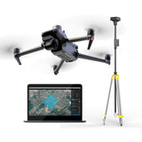
DJI Mavic 3 Enterprise Surveying Drone + RTK Module + D-RTK 2 Mobile Station & Tripod + DJI Terra (1-year subscription)

The DJI Mavic 3 Enterprise Survey Bundle brings mapping an mission efficiency to new heights. Featuring the DJI Mavic 3E Enterprise Survey Drone fully equipped with a mechanical shutter, a 56× zoom camera, RTK module for centimeter-level precision, DJI’s upgraded high-precision D-RTK 2 Mobile Station & tripod, and a 1-year subscription to DJI Terra Software.

DJI Mavic 3E Features:

  • Wide

4/3 CMOS, 20MP, Mechanical Shutter

  • Tele

Equivalent Focal Length: 162mm, 12MP, 56× Hybrid Zoom

D-RTK 2 Mobile Station Features:

  • Built-in high-precision 6-axis accelerometer
  • D-RTK 2 movement monitoring
  • Sloping measurements
  • Electronic bubble level
  • Connect multiple drones to conduct coordinated operations
  • IP65 Ingress Protection


RTK Module Features:

Enables centimeter-level positioning with low power consumption and powerful performance.

  • RTK Positioning Accuracy:
    RTK fix:

Horizontal: 1 cm + 1 ppm
Vertical: 1.5 cm + 1 ppm


What's included in the bundle:

1x DJI Mavic 3E Enterpise Survey Drone
1x DJI Mavic 3 Enterprise RTK Module
1x DJI D-RTK 2 Mobile Station
1x Tripod
1x DJI Terra Mapping Software (1-year subscription)

1x DJI RC Pro Enterprise
3x DJI Pair Propellers
1x DJI Battery Charger
1x DJI Intelligent Flight Battery

1x DJI Power Cable
1x DJI USB-C Cable
1x Enterprise Protector Case


DJI Mavic 3E Enterprise Survey Drone and RTK Module Top Features

Compact and Portable

4/3 CMOS Wide Camera [1]

56× Hybrid Zoom

45-min Max Flight Time [3]

DJI O3 Enterprise Transmission

Centimeter-level Positioning with RTK [4]

High-Volume Loudspeaker [4]


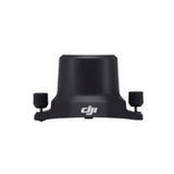
DJI Mavic 3 Enterprise RTK Module

DJI Mavic 3 Enterprise Series RTK Module is compatible with DJI Mavic 3 Enterprise Series aircraft. It provides centimeter-level precision positioning when used with the Network RTK service, Custom Network RTK service, or D-RTK 2 Mobile Station.

Tips

To ensure positioning accuracy, use in open areas that are clear of buildings and other obstacles.

RTK Module

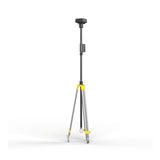
DJI D-RTK 2 High Precision GNSS Mobile Station

The DJI D-RTK 2 Mobile Station is DJI’s upgraded high-precision GNSS receiver that supports all major global satellite navigation systems, providing real-time differential corrections that generate centimeter-level positioning data for improved relative accuracy.

The DJI D-RTK 2 Mobile Station fully supports GPS, GLONASS, Beidou, and GALILEO signals. Easy and quick to set up, the D-RTK 2 Mobile Station provides real-time differential data for drones to achieve centimeter-level positioning accuracy. The built-in high-gain antenna offers better signal reception from more satellites even when obstructions are present.

The DJI D-RTK 2 Mobile Station supports communication via 4G, OcuSync, WiFi, and LAN, ensuring uninterrupted, stable data transmission under any application scenario. Up to 5 remote controllers* can be connected to the D-RTK 2 Mobile Station simultaneously when used with DJI Agras drones, the Phantom 4 RTK, or the P4 Multispectral. When used with the Matrice 300 RTK, it can be connected to multiple aircraft, making coordinated operations involving multiple drones a possibility and significantly improving efficiency.

The DJI D-RTK 2 high precision mobile station features IP65 level ingress protection with a lightweight carbon fiber body, the D-RTK 2 Mobile Station is ultra-portable and up for any task, no matter how tough. The built-in IMUs monitor movements and calibrate the tilt sensors to alert the operator of any abnormalities during the mission, minimizing risks.


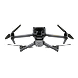
DJI Mavic 3E Enterprise Survey Drone

Premium Camera Performance

Survey with Speed

The Mavic 3E's wide-angle 4/3 CMOS, 20MP sensor has a mechanical shutter to prevent motion blur and supports rapid 0.7-second interval shooting. Complete mapping missions with extraordinary efficiency without the need for Ground Control Points.

Improved Low-Light Performance

The Mavic 3E's Wide camera has large 3.3μm pixels that, together with intelligent low-light mode, offer significantly improved performance in dim conditions.

Focus and Find

Both the Mavic 3E and Mavic 3T are equipped with a 12MP Zoom Camera, supporting up to 56× Max Hybrid Zoom to see essential details from afar.


Next-Generation Image Transmission

Quad-antenna O3 Enterprise Transmission enables more stable connections in a wide variety of complex environments.

Omnidirectional Sensing for Safe Flying

Equipped with wide-angle lenses on all sides for omnidirectional obstacle avoidance with zero blind spots. Adjust proximity alarms and braking distance depending on mission requirements. [6]

Advanced RTH automatically plans the optimal route home, saving power, time, and hassle.

APAS 5.0 enables automatic rerouting around obstacles, so you can fly with peace of mind. [7]


DJI Terra Mapping Software

Make the World Your Digital Asset

Plan. Process. Analyze and Execute.

Plan. Process. Analyze and Execute. DJI Terra

Mission Planning

Data Acquisition

Area Mapping

Data Analysis


Mission Type

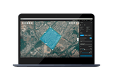
Create efficient flight paths using predefined waypoint actions and adjustable parameters like altitude, speed, gimbal pitch angle, aircraft heading and more. For more complex and tight missions that require high attention to detail, use 3D Flight Visualization to design and simulate tasks on existing 3D models.

With just a few taps on the screen, you can automate complex missions, allowing you to seamlessly capture imagery which can be processed to produce a variety of maps and models for further analysis, and to aid decision-making.

When accuracy is essential and details are vital to your critical operations, Oblique lets you capture a rich 3D model data set by adjusting the angle of the camera at a tilted angle, giving you an extra crisp view of the asset.

Create automated flight missions around roads and railways by simply drawing a line on the map. Adjust mission settings to change the total area mapped, giving you the flexibility to choose between creating high-definition 2D maps and 3D models or quick overviews.

Automatically generate waypoints and flight routes based on one or more points selected in a local 3D model or point cloud (or a third-party point cloud). A simulated camera view including the selected point is displayed onscreen to enable better waypoint selection and more efficient flight route planning, automating inspection workflows.


Seamless Workflows, Accurate Results

Unparalleled efficiency and user experience

Import images with ease while navigating the intuitively designed interface effortlessly.

Bulk process up to 400 images/1 GB of RAM1, minimizing the wait time between field work and digital visualization.

Run reconstruction missions by employing multiple graphics cards simultaneously to improve efficiency.

Meet and exceed your project standards

Generate highly detailed 2D orthomosaics and 3D models with enhanced absolute accuracy by setting Ground Control Points (GCPs) and checkpoints, so you can measure and inspect with ease.

View a quality report of your mission to ensure the results meet your accuracy standards.

Compatibility and flexibility

Convert the coordinates of your maps and models into 8500+ major coordinate systems by simply selecting the output that fits your needs.

Incorporate POS data, GCPs, or both sets of data to create georeferenced maps and models with enhanced accuracy directly in the target coordinate system required by the project.


Mapping

2D Maps

Real-time Mapping

Quickly generate a 2D orthomosaic of the selected area in real-time. Not only is this ideal for creating detailed flight paths in remote areas but it’s also useful for time-sensitive missions that require quick decision-making on site.

2D Reconstruction

Generate high resolution orthomosaics, enabling you to get detailed and accurate measurement results for all your critical projects.

2D Multispectral Reconstruction3

Process multispectral images to generate vegetation index maps including NDVI and NDRE. Create prescription maps for variable rate application using DJI’s Agras drones to improve crop yields while driving down costs.


3D Models

Real-time 3D Point Cloud4

When efficiency is key, quickly render and visualize a 3D point cloud of the mapped area. Make decisions based on the preliminary model and check for completeness immediately or plan 3D flights on-site.

3D Reconstruction

Get sharp and realistic representations of your surroundings throughout various industrial applications, be it accident reconstruction, recreating thin power lines and complex vertical structures, managing major construction projects and more. The CUDA-based reconstruction algorithms are capable of quickly processing large amounts of data to deliver quality results.

With Region of Interest, image reconstruction can be performed to specific target region. In turn, this saves processing time and improves efficiency, while generating a clearer model or point cloud.


Data Analysis

DJI Terra Coordinate
DJI Terra Distance
DJI Terra Area
DJI Terra Volume

2D & 3D Measurements

Acquire key dimensions across an array of terrains with easy-to-use analysis tools that enable you to obtain a variety of measurement data based on linear, area and volumetric measurements.

Annotation

Edit labels of measurements on existing models, which can be used for reporting and improving communication throughout ongoing projects.

DJI Terra Annotation
DJI Terra Photo Inspection

Photo Inspection

Closely inspect every photo of the model so you can pinpoint and highlight any critical elements in the real world.


The Beginning of Next Generation Mapping Solutions

Harness the power of AI-driven mapping solutions designed to take your industrial projects to the next level. Whether it’s object classification, site inspections and more, you can start developing task-specific mapping solutions to seamlessly carry out missions.

Data acquisition

Define mission objective, plan desired flight plan, and with a tap of a few buttons, autonomously collect critical data so you can achieve the required outcome.

Data Processing

Utilize refined image recognition technology to generate 2D and 3D data, resulting in a more realistic representation of your assets, objects, surroundings and more.

Data Application

Implement tools and machine learning techniques, which can be used across a variety of different industries – like classification algorithms for identifying trees, objects, and other scenarios.

Execution

Take the required action, and enjoy more efficient processes with machine control – be it automated crop spraying, monitoring work sites, transporting materials and more.


Get a Quote

Please complete the form below to submit your quote request.